 Italian Antarctic Data Center
FORMATO_DISTRIBUZIONE_DATI (ASCII, CSV, NetCDF...)
Type of resources
Available actions
Topics
INSPIRE themes
Provided by
Years
Formats
Representation types
Update frequencies
status
Scale
-
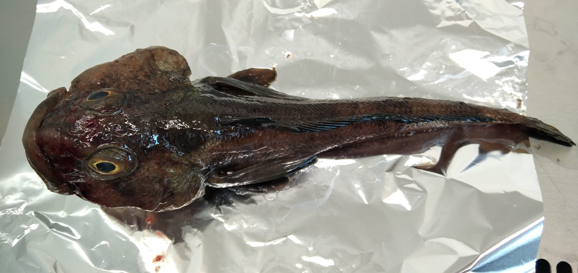
Anthropogenic microparticles (AMs) were found for the first time in specimens of Trematomus bernacchii collected in 1998 in the Ross Sea (Antarctica) and stored in the Antarctic Environmental Specimen Bank. Most of the identified AMs were fibers of natural and synthetic origin. The natural AMs were cellulosic, the synthetic ones were polyester, polypropylene, polypropylene/polyester, and cellulose acetate. The presence of dyes in the natural AMs indicates their anthropogenic origin. Five industrial dyes were identified by Raman spectroscopy with Indigo occurring in most of them (55%). Our research not only adds further data to the ongoing knowledge of pollution levels in the Antarctic ecosystem, it provides an interesting snapshot of the past, highlighting that microplastics and anthropogenic fiber pollution had already entered the Antarctic marine food web at the end of the ‘90 s. These findings therefore establish the foundations for understand the changes in marine litter pollution over time.
-

Multidisciplinary dataset acquired within the fumarolic ice caves of Mt. Melbourne (Aurora/MC1, MC3, and MC4). Includes continuous gas concentrations (CO2, H2O, CH4, etc.), soil CO2 fluxes, and high-resolution air/soil temperatures (depths of 20 cm and 60 cm). Data is used to track indicators of volcanic unrest in polar environments.
-
The data are related to the ionic composition of atmospheric aerosol continuously collected at Dome C. They refer to PM10 and size-segregated aerosol collected at 2-day and 4-day resolution, respectively. The measured chemical parameters include main and trace inorganic anions and cations and selected organic anions (methanesulphonic acid - MSA).
-

We present the snow samples collected for the PASSPORT project during the 2025-2026 Antarctic Campaign. We report the number of snow samples collected, the depth of the samplings, their geographic information, the sampling and treatment date, the treated volume, snow density and temperature and weather conditions.
-
Concentrations of major, minor and trace elements in particulate matter (PM10) samples, collected at Concordia with monthly time resolution, since January 2018, obtained by PIXE-PIGE and HR-ICP-MS measurements.
-
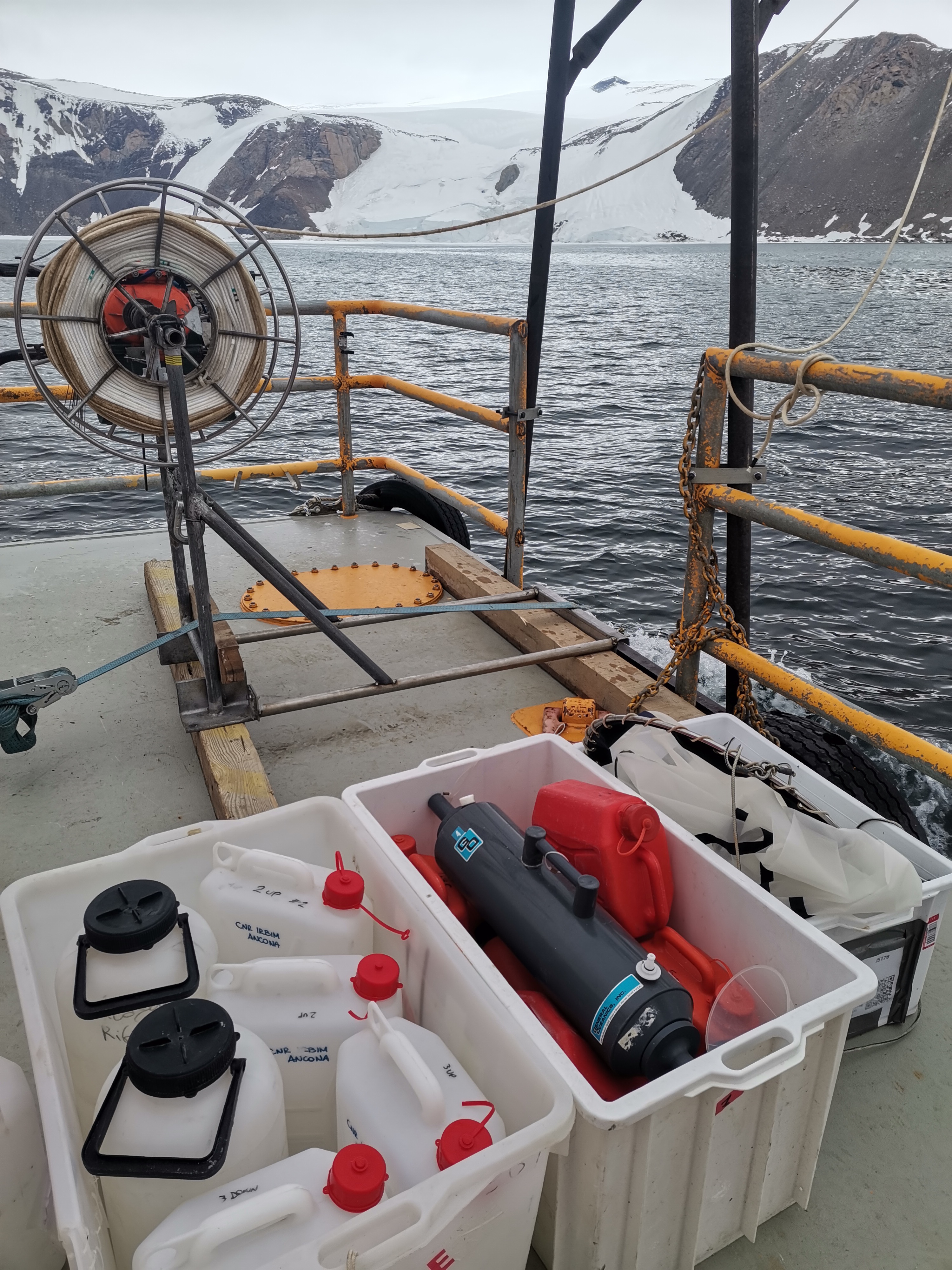
The effects of sea ice melting, and the consequent changes in the trophic conditions in Antarctic ecosystems, have been focused on phytoplankton with cross-food web links from krill to penguins, while the consequences on the planktonic microbial food web (viruses, prokaryotes and unicellular eukaryotes), driving biogeochemical cycles, have been largely ignored. This research investigates how changes related to sea ice melting influence the diversity and functioning of planktonic microbes in the Ross Sea coastal ecosystem of Terranova Bay. The objectives are: i) to investigate the temporal changes of planktonic microbial biodiversity, ii) to investigate the biodiversity/ecosystem functioning relationships iii) to assess the role of viruses on biodiversity and biogeochemical cycles, iv) to identify the drivers that shape microbial biodiversity and functions, and v) to shed light on the interactions within the planktonic food web, and their response to the ice melting. META-ICE-ROSS integrates ad hoc sampling with sophisticated methodologies of high-throughput sequencing of microbial DNA (metagenomics), never documented in previous Italian expeditions at Terranova Bay. The sampling includes the collection of seawater beneath the pack ice at increasing distance from the MZ Station and characterised by different thermohaline conditions, on a weekly basis from early November to mid January. The groundbreaking nature of META-ICE-ROSS will allow to provide unprecedented evidences on the role of microbial interactions in the functioning of the Ross Sea coastal ecosystem, to improve knowledge on biological changes due to global climate changes and, nonetheless, to provide a baseline assessment of the functioning of the microbial food webs and carbon sequestration in the pelagic environment in the Ross Sea region, within the context of the Ross Sea Region Marine Protected Area (RSRMPA) and its monitoring and research plan.
-

The MBES NZ-water dataset was collected during the XXXIX PNRA Italian Antarctic Expedition aboard R/V Laura Bassi in direct response to a request from New Zealand to acquire bathymetric data during transits within their waters. The acquisition of this valuable dataset was carried out by the ISOBatA Project team, utilizing a state-of-the-art multibeam EM304 system installed on the R/V Laura Bassi. The genesis of the MBES NZ-water dataset is deeply linked to the international collaborative effort aimed at mapping unexplored regions, exemplified by the Seabed 2030 Project. By aligning with New Zealand's research objectives, both the ISOBatA project and the Italian Antarctic Expedition epitomize their commitment to knowledge exchange and the advancement of scientific understanding on a global scale.
-
Isotopic composition (Pb and Sr) in particulate matter (PM10) samples, collected at Concordia with monthly time resolution, since January 2018, obtained by ICP-MS.
-

The raw SeaSpy magnetometer data presented here were collected in the Southern Ocean (SO) as part of the ISOBatA PNRA project during the XXXVII and XXXVIII Italian Antarctic expeditions on board the icebreaker Laura Bassi. The ISOBatA project (Italian Southern Ocean Bathymetry from consistent exploitation of opportunistic seafloor datasets in the Antarctic region and surrounding areas) aimed to improve the understanding of the Southern Ocean through a novel approach that systematically integrates the collection of bathymetric and magnetometric data during the Laura Bassi voyages in poorly charted regions between the Macquarie Triple Junction – MTJ and the Emerald Fracture Zone n-EFZ. This dataset spans two field campaigns (2021-2022 and 2023) collected through optimized navigation strategies, including reducing vessel speed during transits and following pre-planned corridors to enhance data quality and spatial coverage. The project was a collaboration between OGS (PI D. Accettella), UniMIB (A. Savini), IGAG-CNR (M. Cuffaro) and INGV (F. Muccini). The work was supported by the Programma Nazionale di Ricerca in Antartide - PNRA and benefited from the joint efforts of the Laura Bassi research teams on board. Keywords: Southern Ocean, Bathymetry, ISOBatA, Laura Bassi, Antarctica, IBCSO.
-

We present here the final 100-meter cell size grid projection EPSG:9354 and metadata from the ISOBatA PNRA project, shared with the Alfred Wegener Institute (AWI) as part of the International Bathymetric Chart of the Southern Ocean (IBCSO). This dataset was collected by the ISOBatA project team using the Kongsberg EM304 multibeam system installed on the R/V Laura Bassi. The dataset processed and quality-controlled using QPS Qimera software and corrected for sound velocity using XBT and CTD data (courtesy of the MORSEA project), has been provided to AWI (IBCSO) and is archived here to ensure traceability, wide dissemination, and future usability. The PNRA-funded project ISOBatA (Italian Southern Ocean Bathymetry from consistent exploitation of opportunistic seafloor datasets in the Antarctic region and surrounding areas) introduced an innovative approach to optimize the collection of acoustic (mainly bathymetric) and magnetometric data. The primary objective of the project was to improve the bathymetric understanding of the Southern Ocean by collecting multibeam echosounder data during the Laura Bassi expeditions, focusing on previously unexplored areas in the Ross Sea and in the region between the Macquarie Triple Junction (MQ TJ) and the Emerald Fracture Zone (EMZ). The operational phase of ISOBatA spanned three expeditions: XXXVII (2021-2022), XXXVIII (2023), and XXXIX (2024) of the Laura Bassi in Antarctica. In the first two years (XXXVII and XXXVIII), the project benefited from dedicated ship time, which enabled efficient data collection through strategic speed reductions during transfers and route adjustments along pre-identified corridors. Data collection was planned based on pre-existing metadata, such as IBCSO coverage, the Seismic Data Library (SDL), Italian Mooring Sites, and Italian Coring and Box Coring Sites. This also included transit routes through the Southern Ocean along the MQ and EMZ, as well as unmapped areas in the Ross Sea, such as the Italian MORSEA Mooring Sites. In the third year (XXXIX), no dedicated ship time was available. Nevertheless, ISOBatA managed to collect data under two conditions: 1) without changing the ship's course or speed and 2) by simultaneously collecting acoustic data for other projects, which affected the spatial resolution of the data collected with EM304. Despite the challenges posed by rough seas, ice, ship speeds, and the lack of tide gauges, ISOBatA proved the feasibility of opportunistic acoustic data collection, particularly in the Ross Sea. This was achieved by utilizing downtime during mooring maintenance, support for supply vessels, medical evacuation (MEDEVAC), and sheltering during standby weather conditions. Onboard data sharing fostered valuable collaborations with other research teams, enhancing the overall scientific results. We acknowledge the MORSEA project for providing real-time of XBT and CTD data, which enabled the application of accurate sound velocity profiles. We also thank to the PNRA Program for funding and support, to ISOBatA project partners: OGS (PI D. Accettella, P. Diviacco), UniMIB (A. Savini), IGAG-CNR (M. Cuffaro), and INGV (F. Muccini), as well as the Laura Bassi research teams for their scientific contributions and collaborations. Keywords: Southern Ocean, Bathymetry, ISOBatA, Laura Bassi, Antarctica, IBCSO.